
Mobile LiDAR Cadiz at Riverfront
CEC was tasked with collecting topographic survey data for an intricate and highly trafficked interchange in Dallas, Texas – equating to approximately 69 acres. Due to the complex nature of the interchange, detail and crew safety presented a unique challenge. To meet these challenges, CEC implemented its mobile LiDAR system. Working in concert with field personnel, the team acquired all topographic information in just three days. The 3D laser scan data was then post-processed and a design ready survey drawing was generated. By thinking critically and choosing the right tools, CEC provided a comprehensive topographic survey efficiently, accurately – and most importantly – safely.
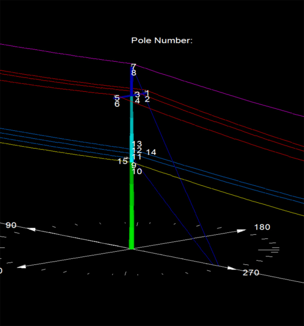
Pole Loading Analysis in Texas
Our team performed Pole Loading Analysis on 1200 Xcel Energy poles in Texas.
More Details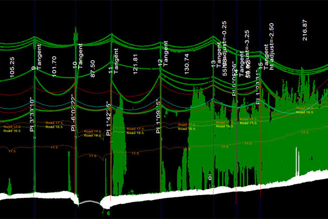
Fiber Analysis in Oklahoma
This project included physical in-field height measurements of all existing conductors and telecommunication lines, as well as LiDAR scanning.
More Details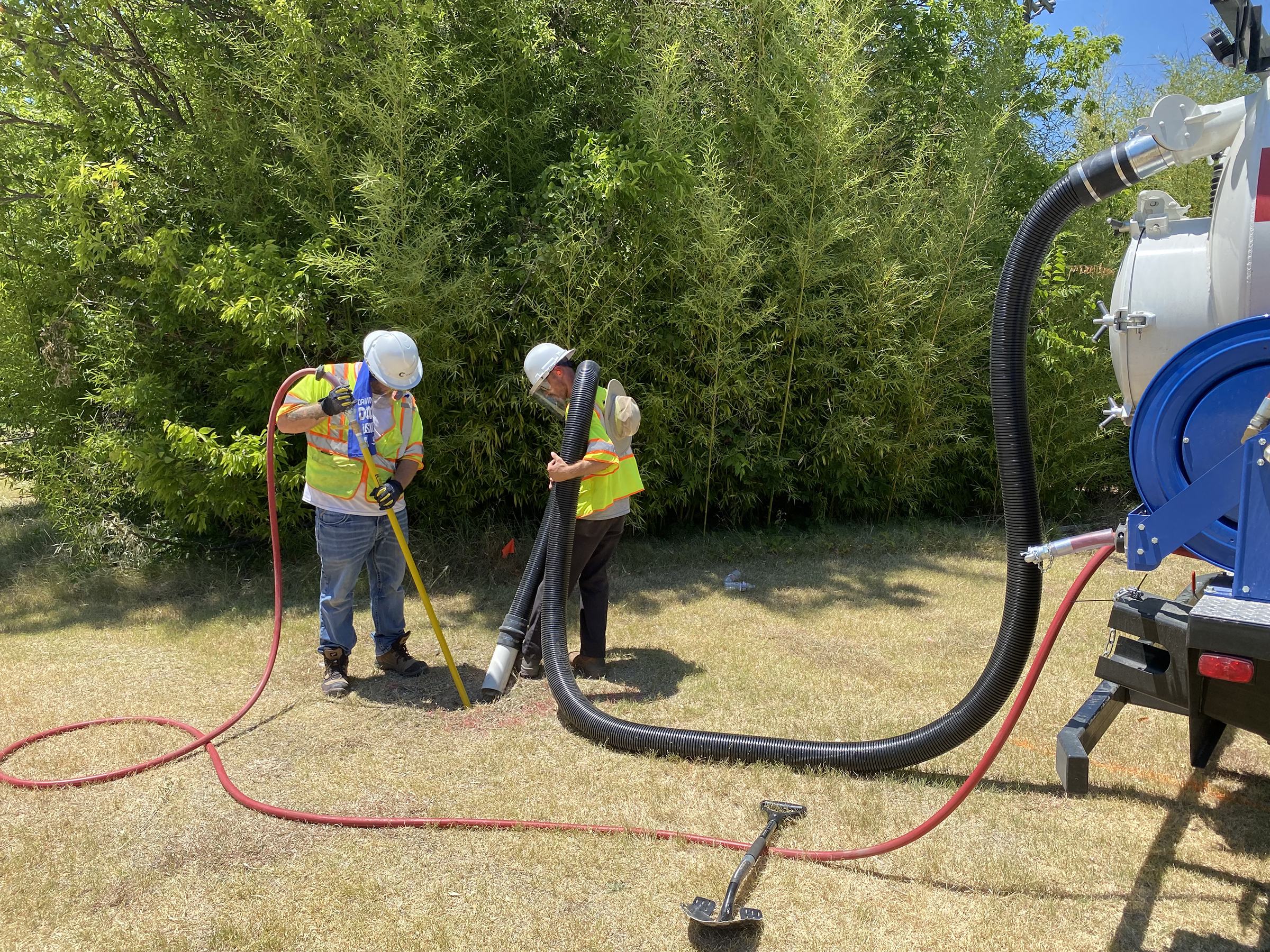
City Of Richardson 30-Inch Waterline
CEC provided Quality Level B Designating and Quality Level A Test Holes for the City of Richardson.
More Details